File list
From GURPSworld Wiki
This special page shows all uploaded files.
| Date | Name | Thumbnail | Size | User | Description | Versions |
|---|---|---|---|---|---|---|
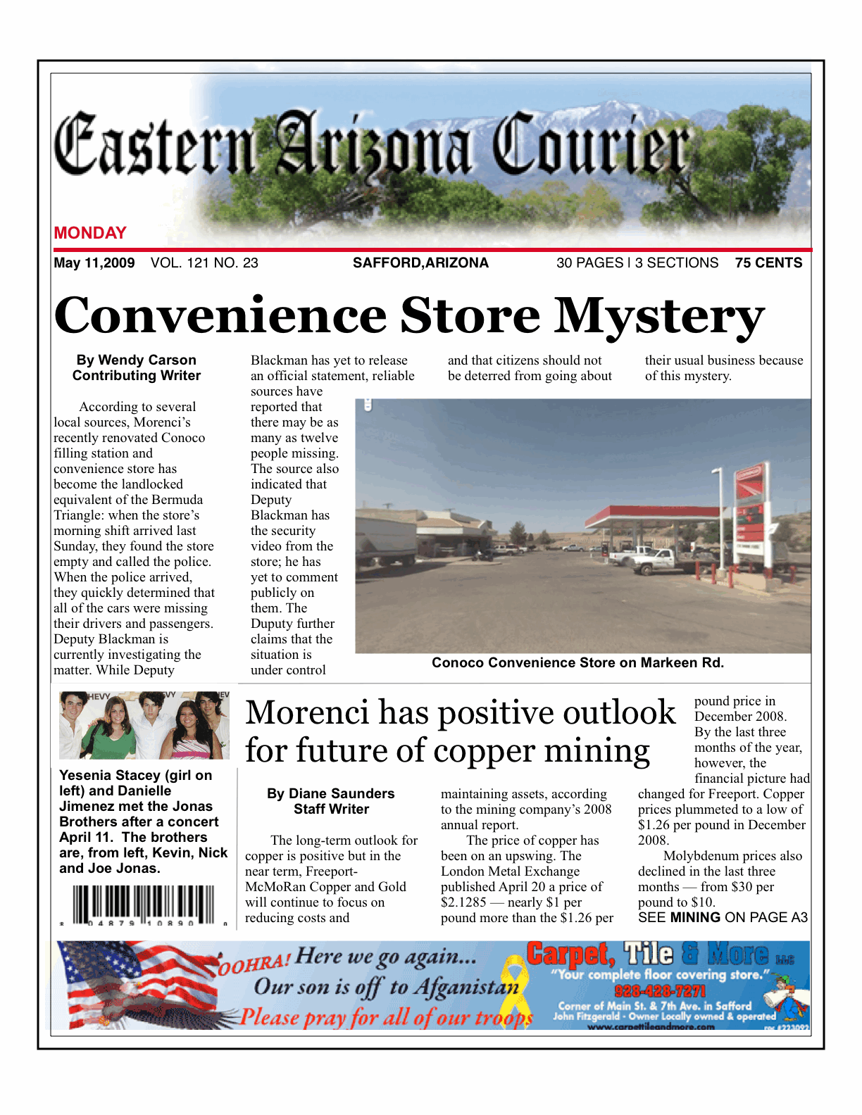
| 08:20, 1 May 2010 | EAC 090511M.gif (file) |  |
385 KB | Cal | 1 | |
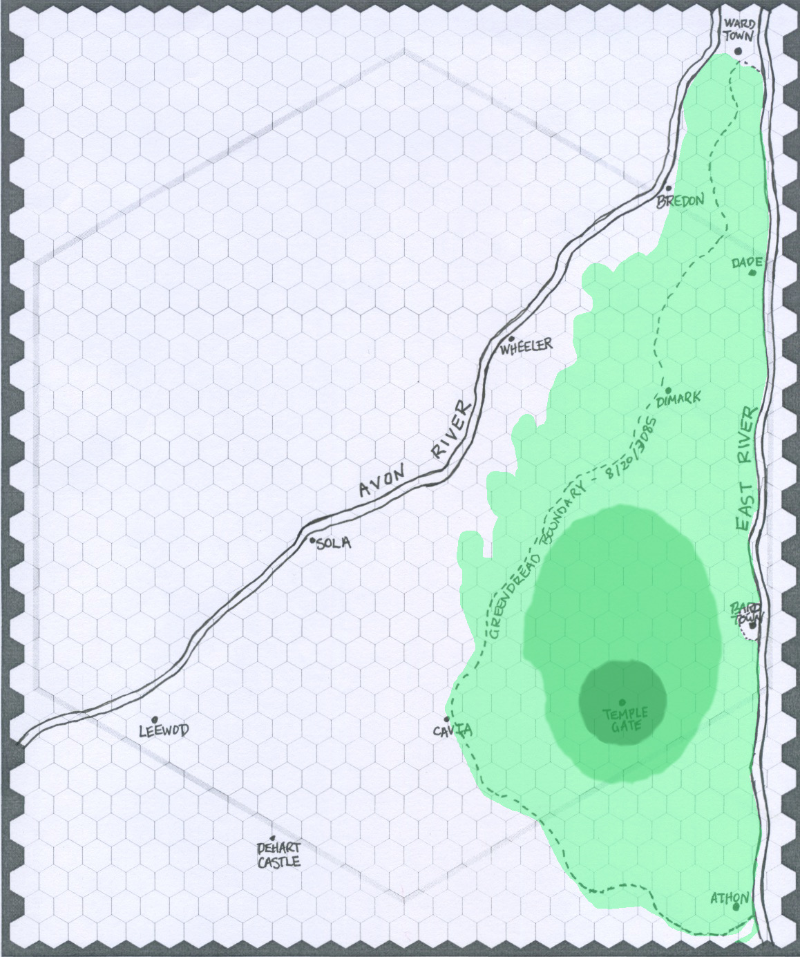
| 19:08, 7 August 2015 | Greendread Map.jpg (file) |  |
393 KB | Cal | Added color to illustrate Greendread growth over time. | 2 |
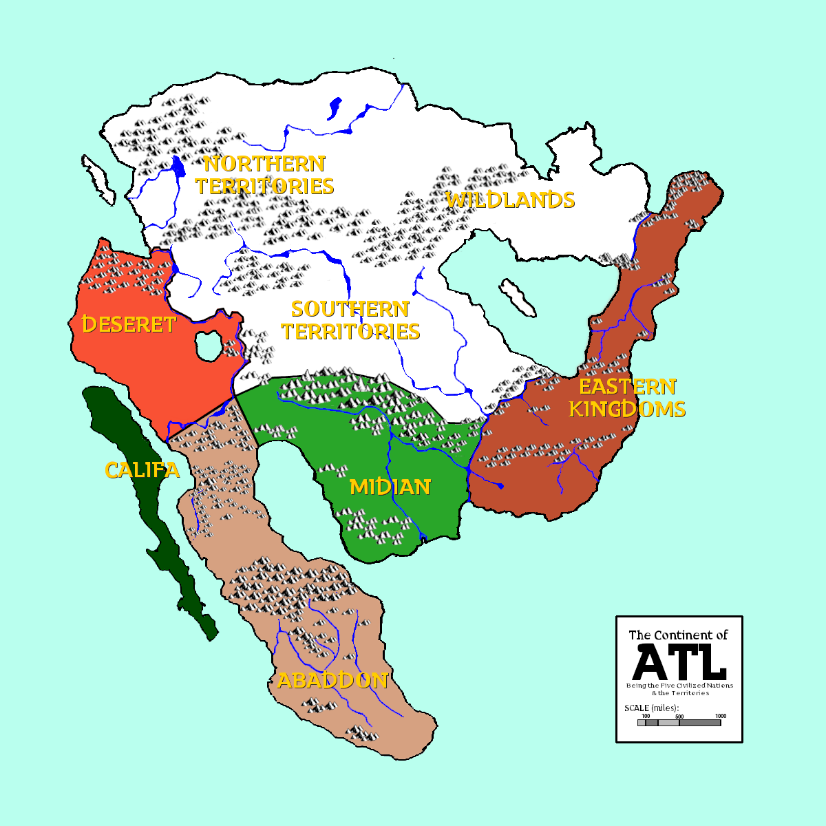
| 22:55, 26 January 2023 | Atl-WorldMap-02.png (file) |  |
403 KB | Cal | Colored map of the continent with nations labeled. Revised 1-26-23. | 1 |
| 04:25, 5 May 2016 | Old Frontiers Sector.jpg (file) |  |
409 KB | Cal | 1 | |
| 06:48, 2 March 2011 | The Wastes.jpg (file) |  |
418 KB | Cal | 1 | |
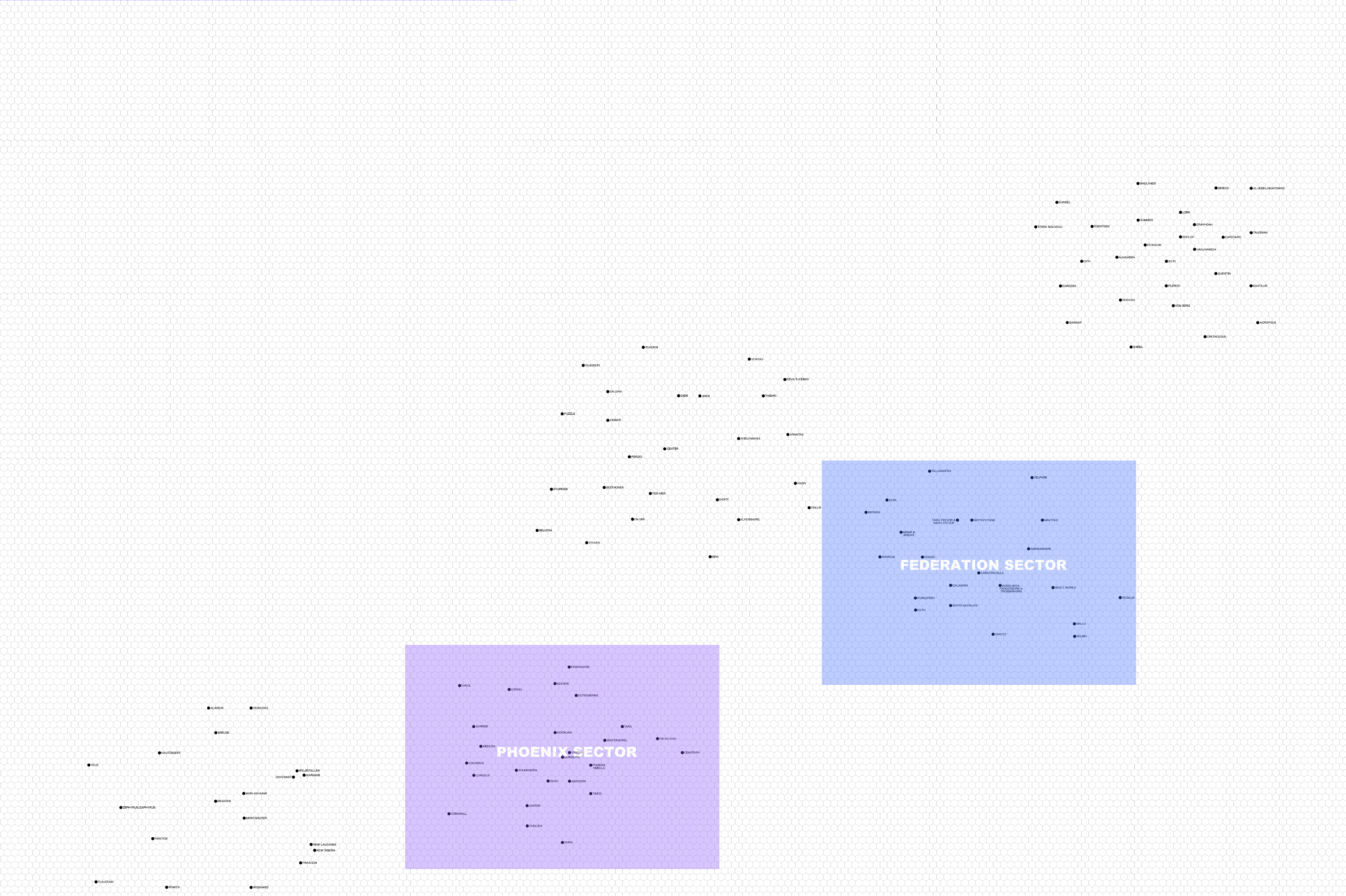
| 04:21, 5 May 2016 | Corporate Sector.jpg (file) |  |
419 KB | Cal | 1 | |
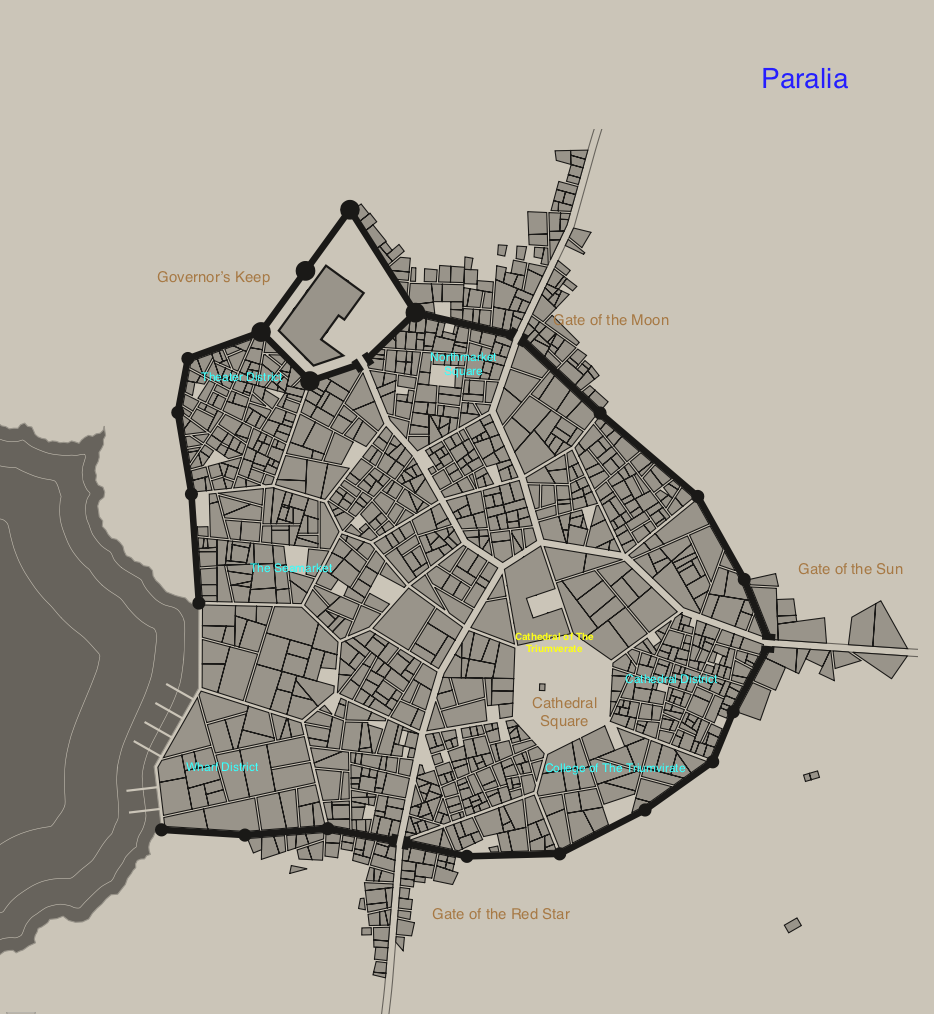
| 05:02, 1 August 2017 | Paralia.png (file) |  |
421 KB | Ben | 1 | |
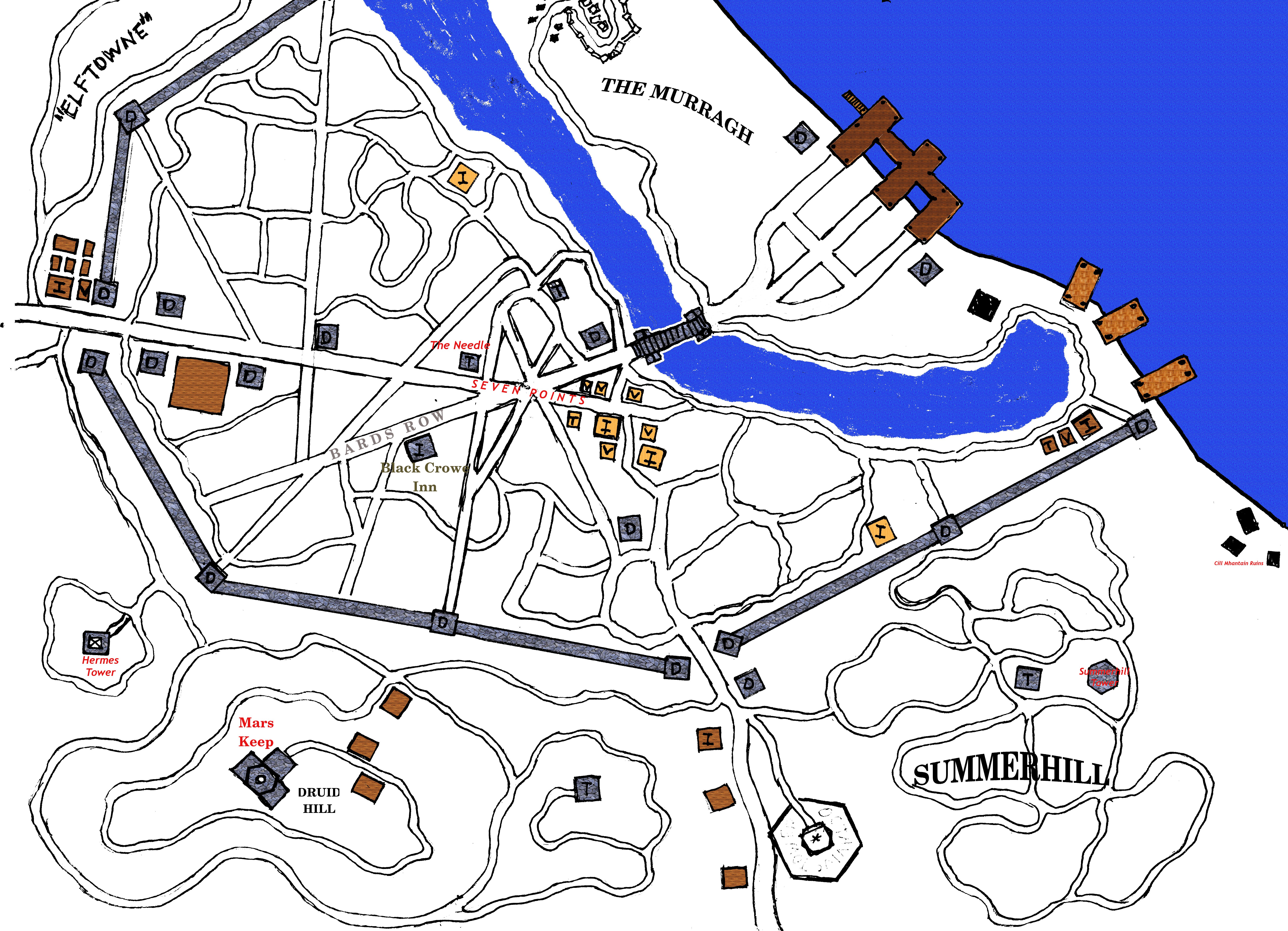
| 20:33, 17 October 2016 | TheCastle.jpg (file) |  |
422 KB | Ben | 1 | |
| 04:24, 5 May 2016 | Federation Sector.jpg (file) |  |
423 KB | Cal | 1 | |
| 06:02, 26 July 2017 | Avernus.png (file) |  |
438 KB | Ben | 1 | |
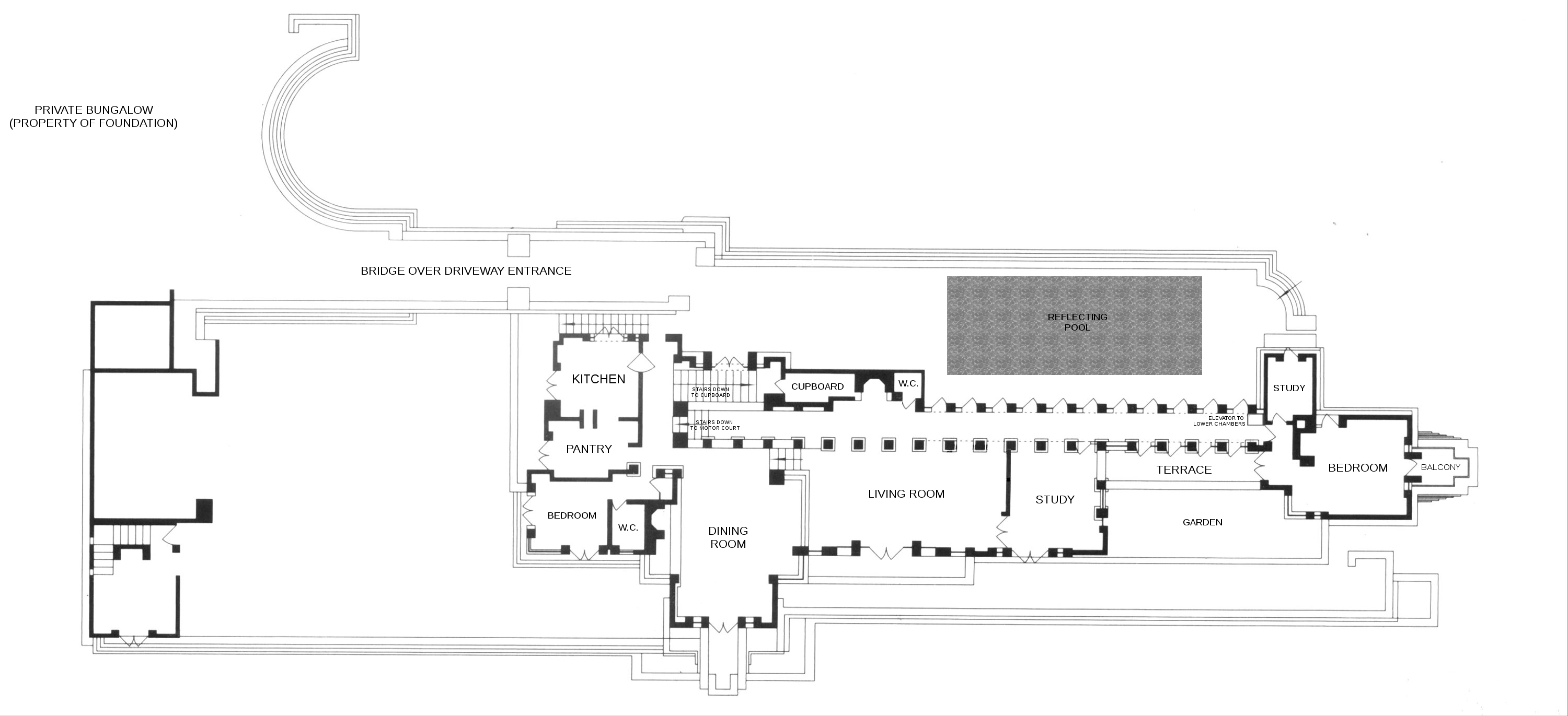
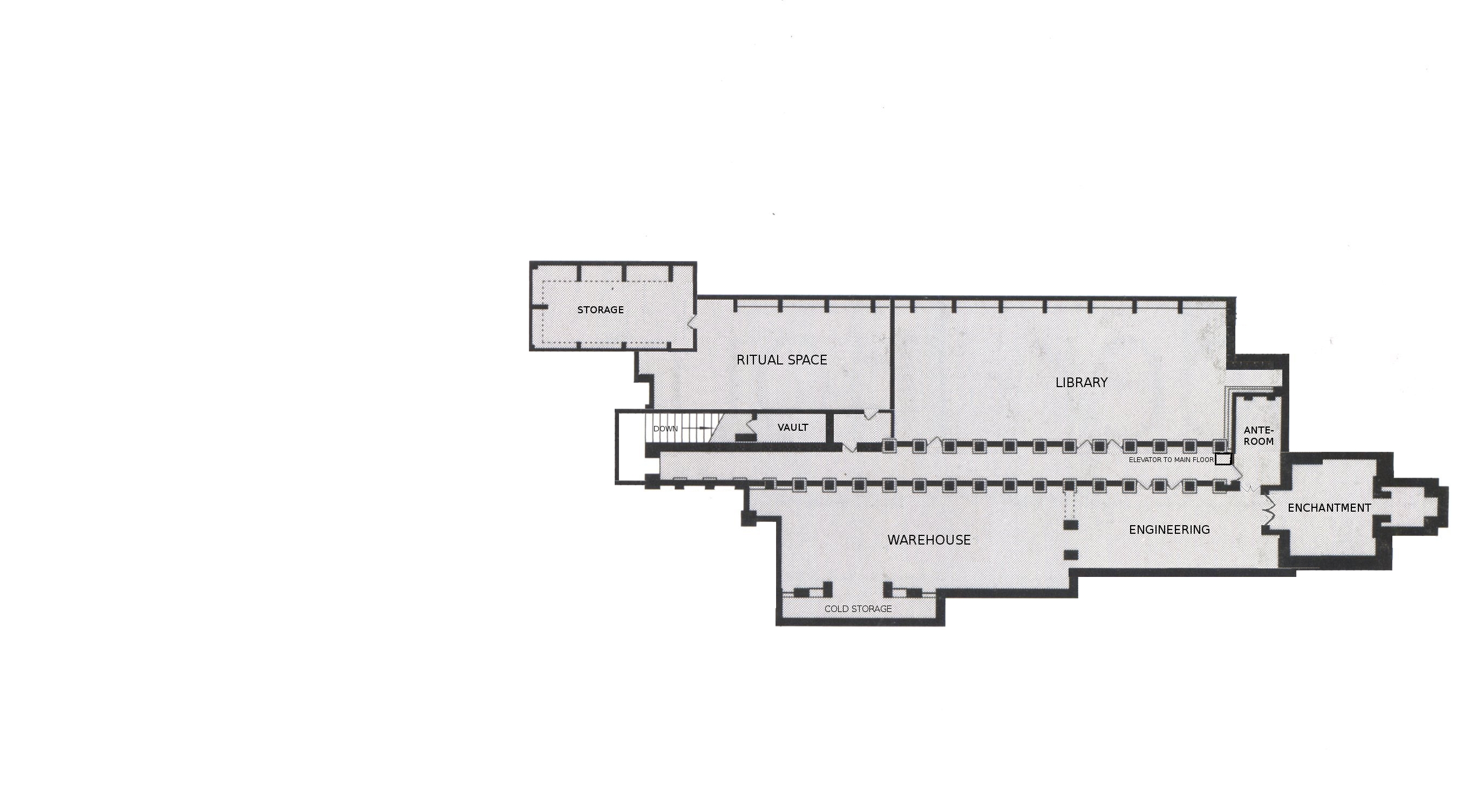
| 04:11, 11 November 2012 | Alden House - Main Floor.jpg (file) |  |
441 KB | Cal | Main Floor of Alden House | 1 |
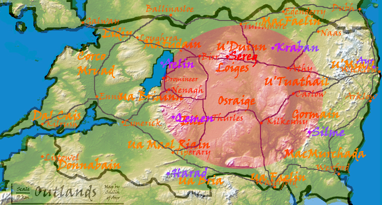
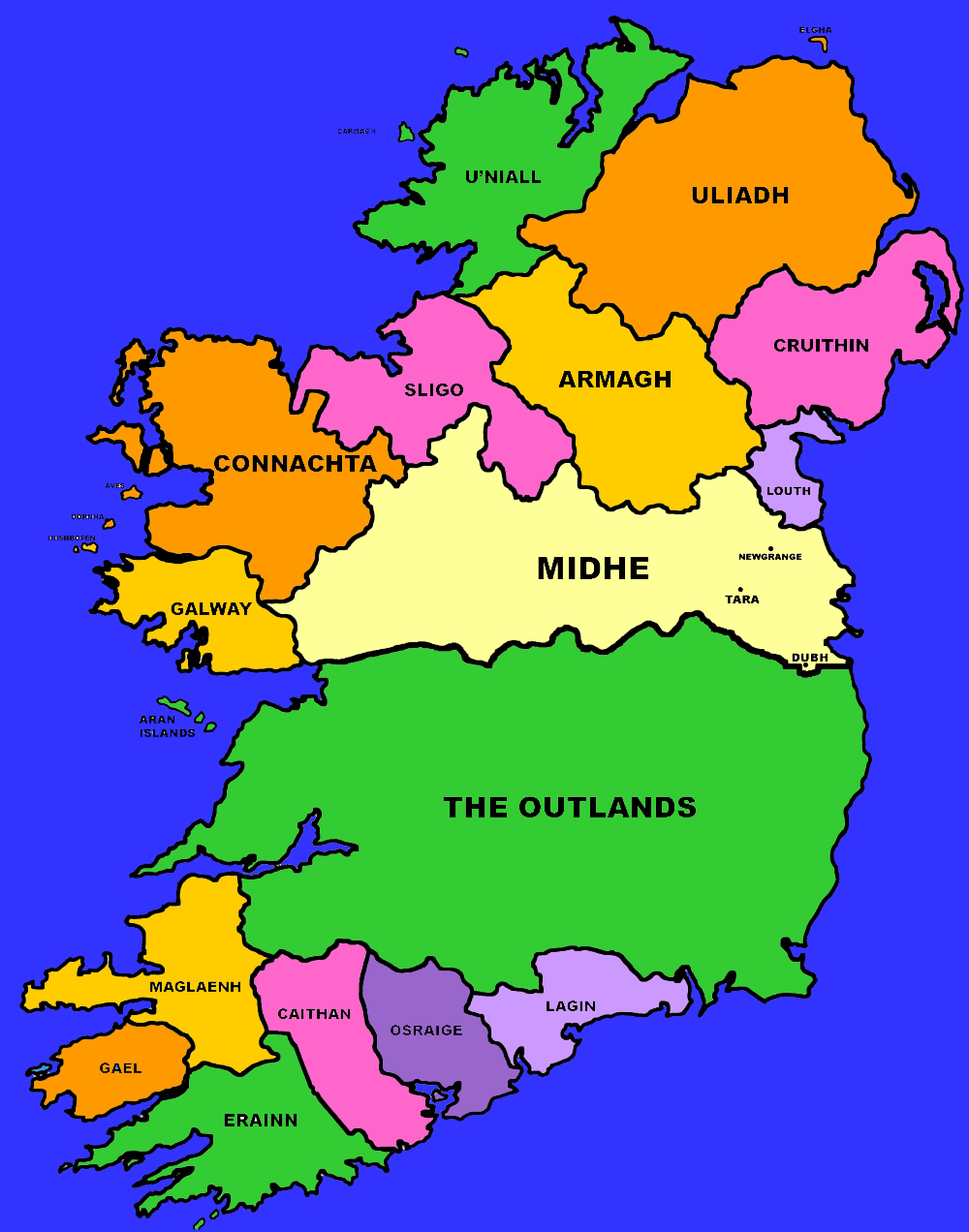
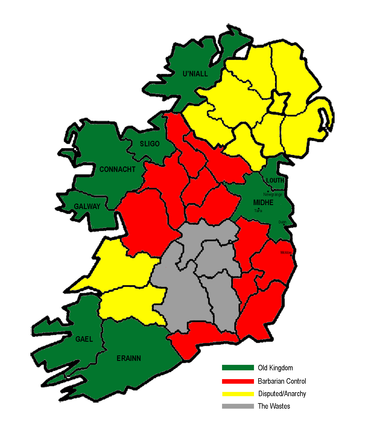
| 06:50, 1 May 2010 | Eire Political.jpg (file) |  |
471 KB | Admin | 1 | |
| 04:03, 12 May 2011 | Teague portrait.png (file) |  |
478 KB | Cal | 1 | |
| 02:30, 3 March 2011 | New Face of Eire.jpg (file) |  |
488 KB | Cal | 3 | |
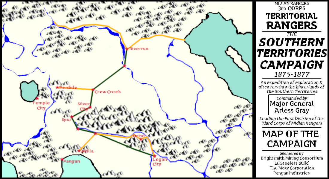
| 02:00, 28 January 2023 | Southern Campaign Map.png (file) |  |
496 KB | Cal | Map of the Southern Territories Campaign undertaken by the 3rd Corps of the Midian Rangers, the Territorial Rangers, in the years 1875-1877. | 1 |
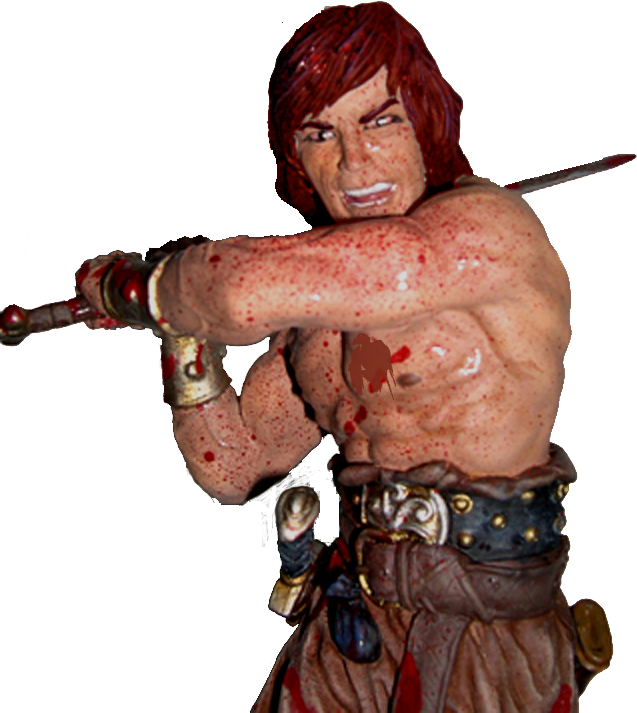
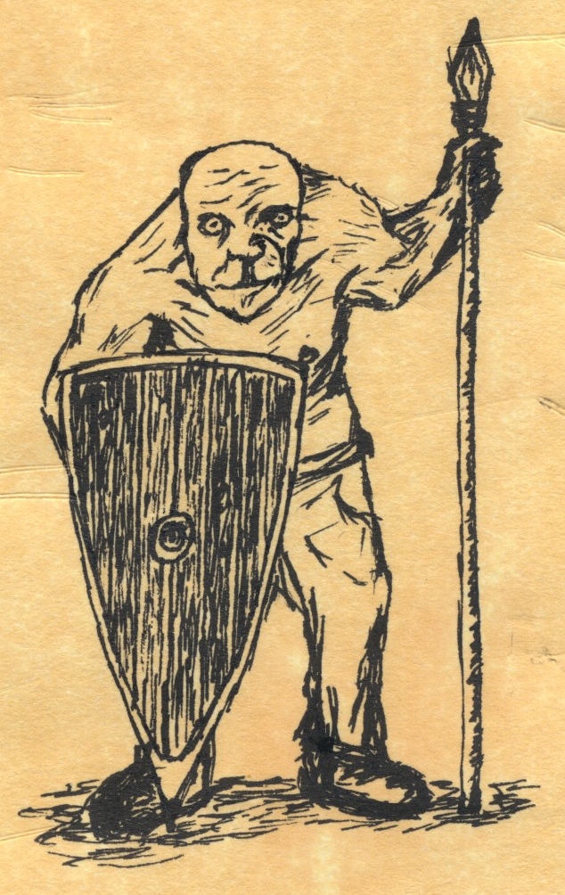
| 02:14, 14 April 2013 | Hugo.jpg (file) |  |
498 KB | Cal | Original drawing by Tim Yerlashov, a.k.a. Ambrose | 1 |
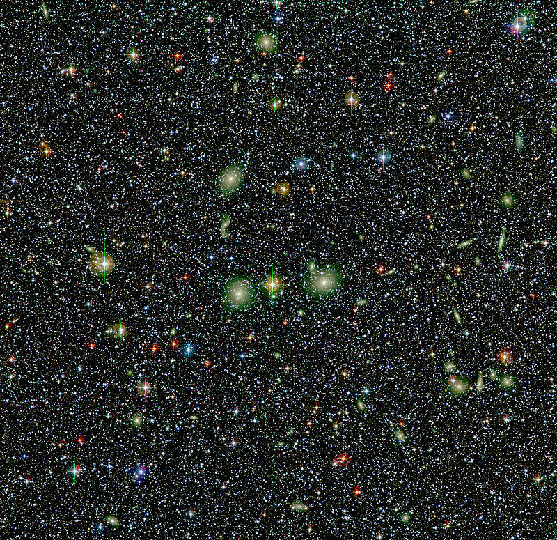
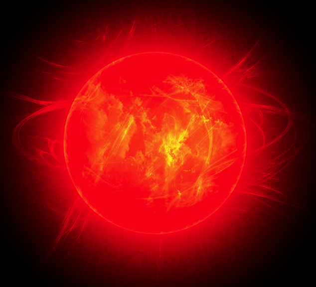
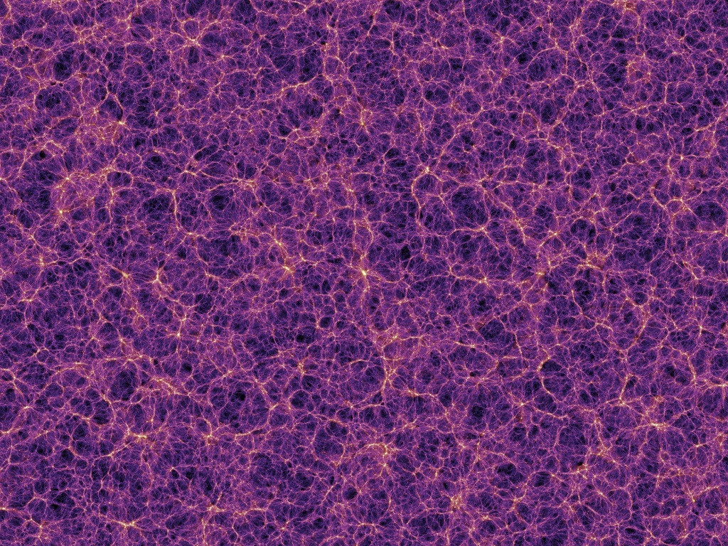
| 05:31, 9 October 2016 | DarkEnergy.jpg (file) |  |
514 KB | Ben | 1 | |
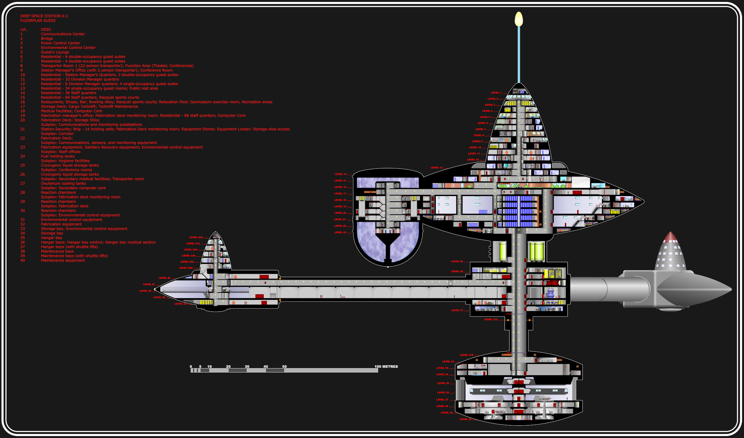
| 22:49, 31 August 2021 | K-1-space-station-inboard-profile.jpg (file) |  |
516 KB | Cal | Inboard profile of Deep Space One, a K-series space station. | 1 |
| 23:49, 18 September 2013 | TeamZero Patch.png (file) |  |
532 KB | Cal | CLASSIFIED | 1 |
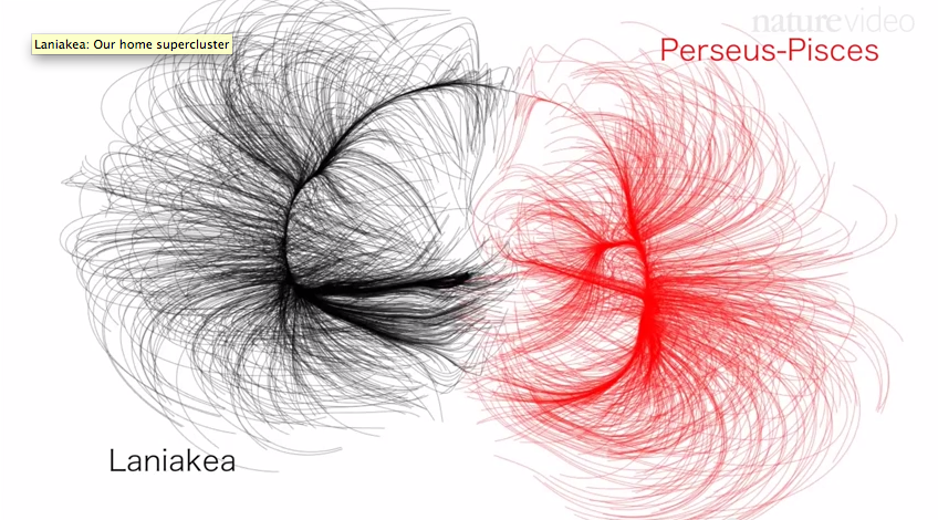
| 06:06, 19 October 2016 | LaniPP2.png (file) |  |
543 KB | Ben | 1 | |
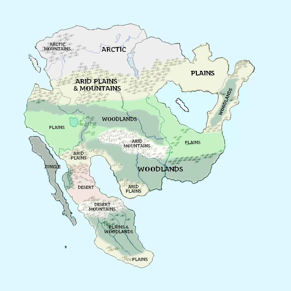
| 23:56, 25 January 2023 | Atl-WorldMap-climate.png (file) |  |
555 KB | Cal | Climate zones of Atl. | 1 |
| 21:46, 4 August 2018 | 497.gif (file) |  |
562 KB | Cal | 1 | |
| 04:19, 11 November 2012 | Alden House - Lower Chambers.jpg (file) |  |
580 KB | Cal | 2 | |
| 08:55, 1 March 2011 | Fallout.jpg (file) |  |
592 KB | Cal | 2 | |
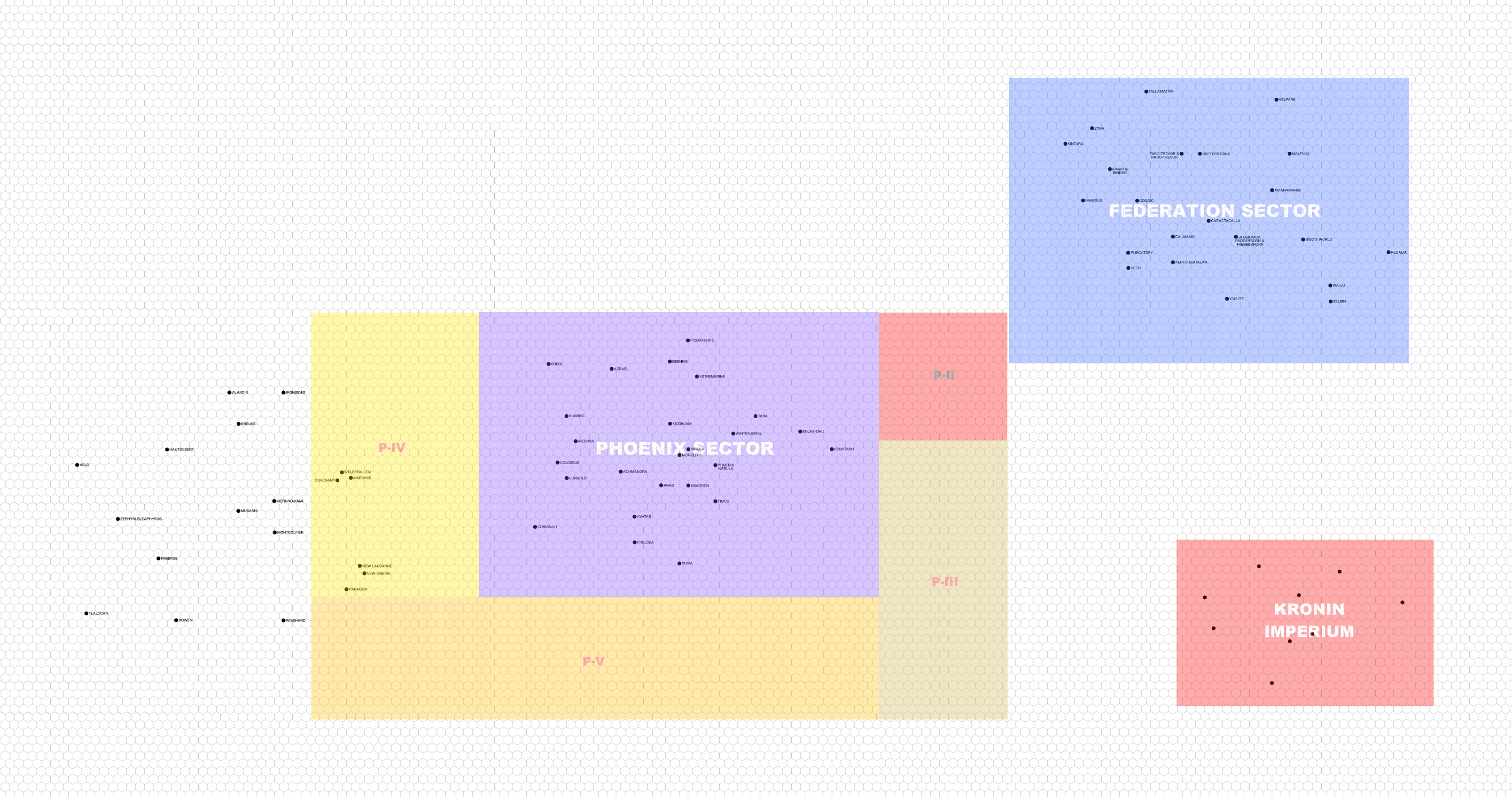
| 04:26, 5 May 2016 | Phoenix Sector.png (file) |  |
603 KB | Cal | 1 | |
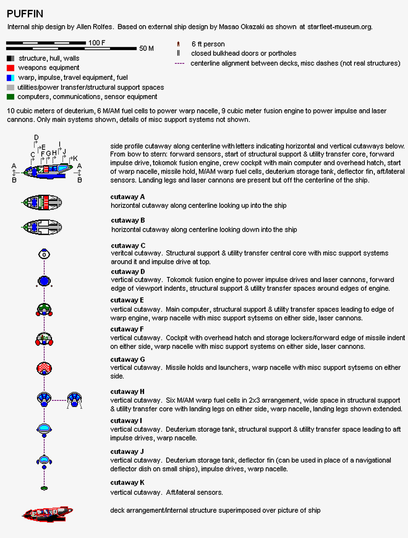
| 22:56, 28 March 2011 | Puffin-plan.jpg (file) |  |
680 KB | Cal | Deck plans for Puffin-class fighter. | 1 |
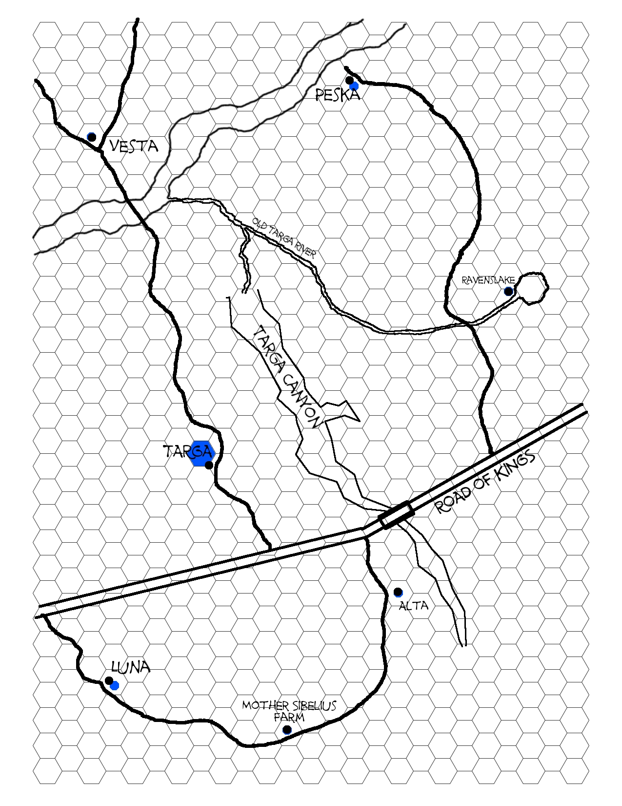
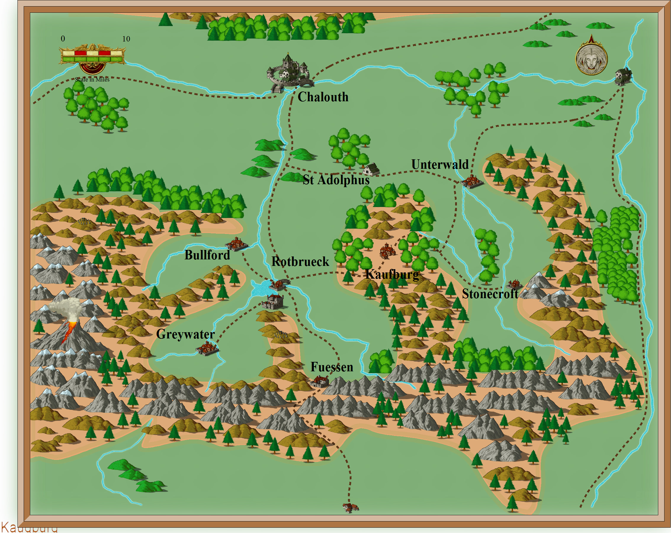
| 22:03, 27 May 2013 | Targa Area Map.jpg (file) |  |
687 KB | Cal | 1 | |
| 02:16, 27 December 2016 | Daily Illuminator 1.jpg (file) |  |
703 KB | Cal | 1 | |
| 04:35, 16 August 2016 | Carcosa (Planetary Record Sheet).jpg (file) | .jpg) |
713 KB | Cal | 1 | |
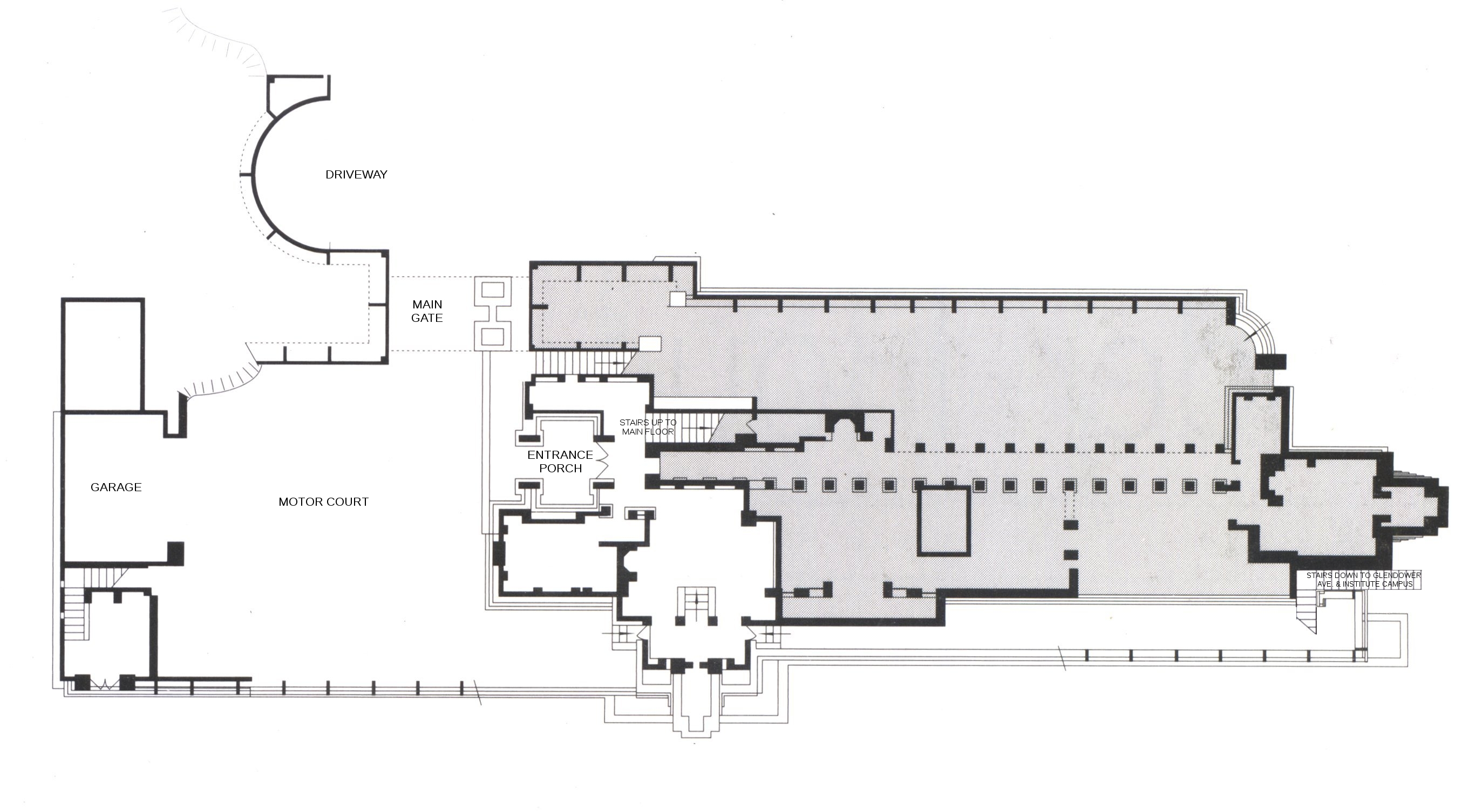
| 04:11, 11 November 2012 | Alden House - Lower Floor.jpg (file) |  |
743 KB | Cal | Drive way, motor court, and lower floor of Alden House | 1 |
| 05:25, 29 May 2015 | Avondale Area Political Map (3085).jpg (file) | .jpg) |
764 KB | Cal | 1 | |
| 02:54, 28 May 2013 | Mahalo.jpg (file) |  |
774 KB | Cal | Mahalo Kaminsky, alias Mahalo Kozmo, alias Kozmo 2.0, alias the Kid. | 1 |
| 21:43, 28 March 2011 | Starfleet ships 2139.jpg (file) |  |
831 KB | Cal | Display chart of Starfleet vessels, 2160-2239. Source: Starfleet Museum. | 1 |
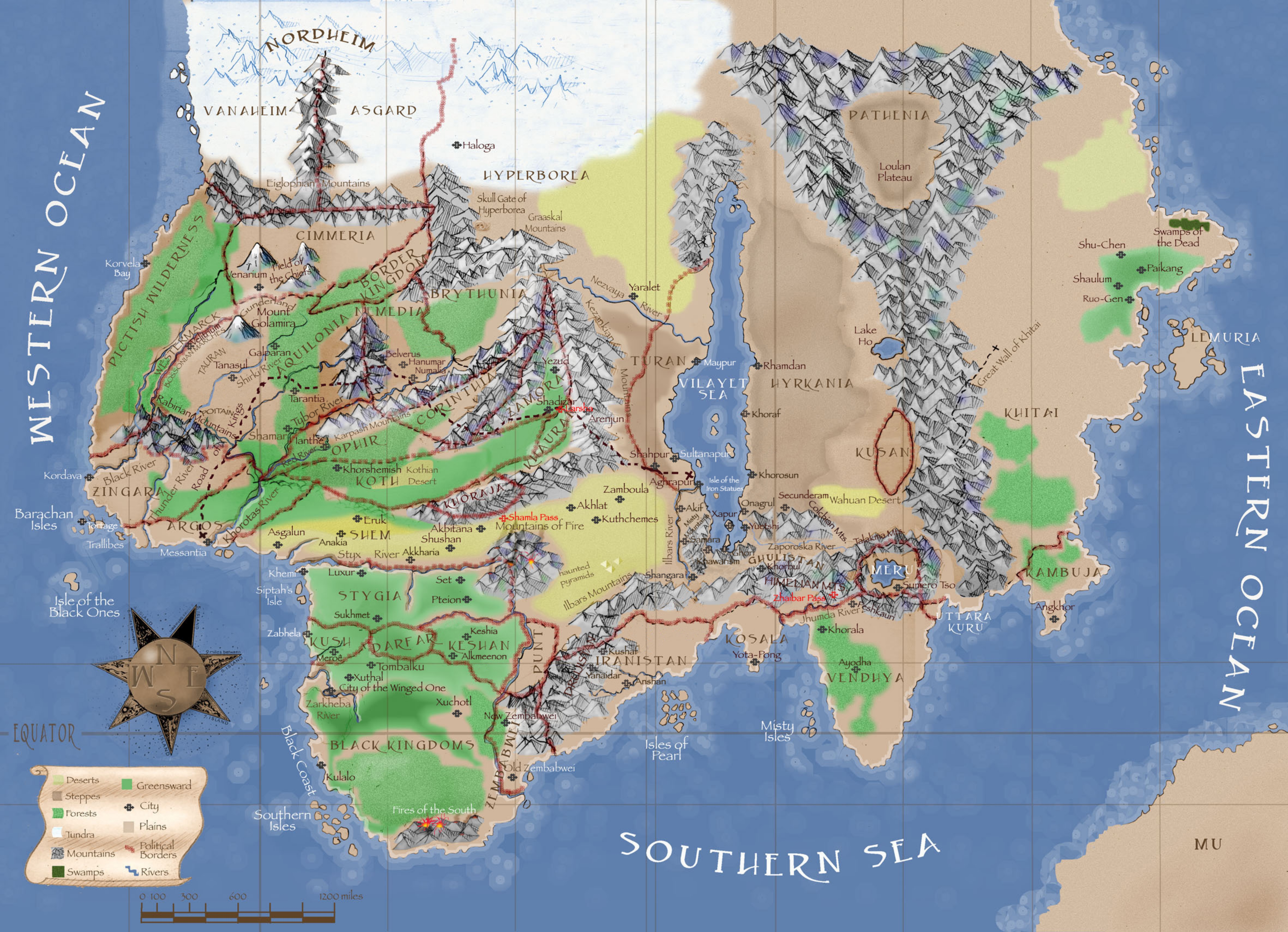
| 07:10, 19 March 2013 | Map Of Hyboria (1200x869).jpg (file) | .jpg) |
837 KB | Cal | 1 | |
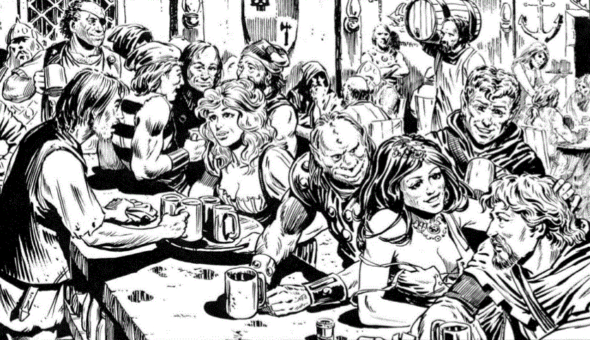
| 08:52, 22 January 2017 | Tavern scene 01.jpg (file) |  |
848 KB | Cal | 1 | |
| 06:42, 19 October 2016 | TaurusVoid.png (file) |  |
924 KB | Ben | 1 | |
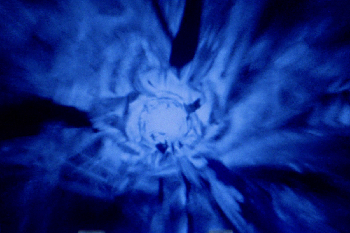
| 22:17, 28 July 2016 | Hyperspacetunnel.png (file) |  |
1.06 MB | Cal | 1 | |
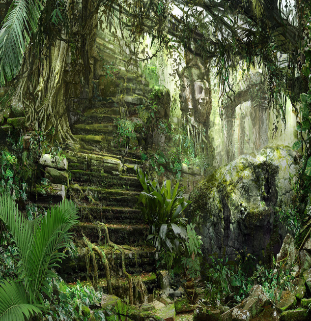
| 05:52, 26 July 2017 | TempleAtNyris.png (file) |  |
1.07 MB | Ben | 1 | |
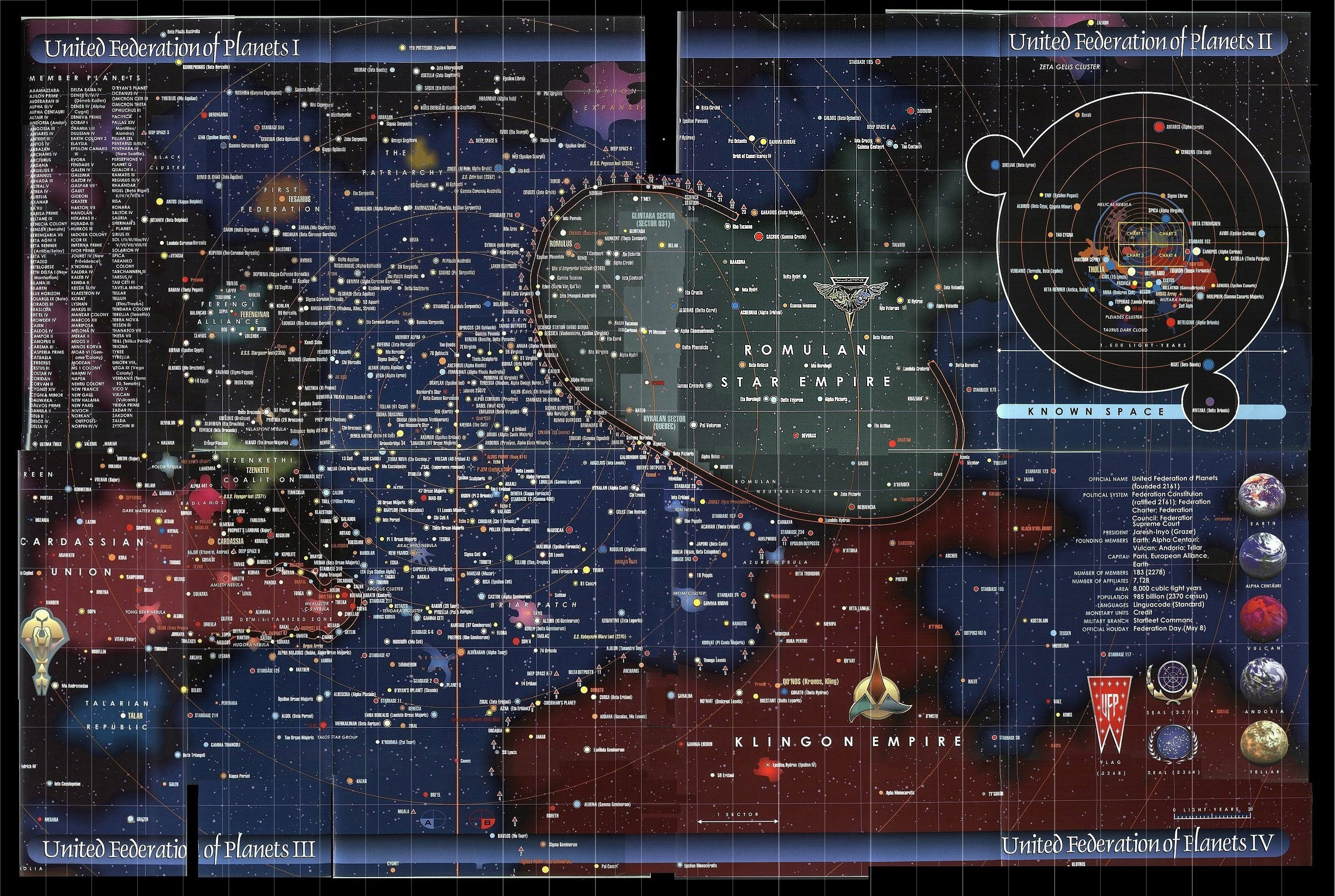
| 22:37, 31 August 2021 | UFP-Map Main.jpg (file) |  |
1.25 MB | Cal | Map of the United Federation of Planets. Approximated for 23rd century. Offical Map for ''Star Trek:Deep Space One'' campign. | 1 |
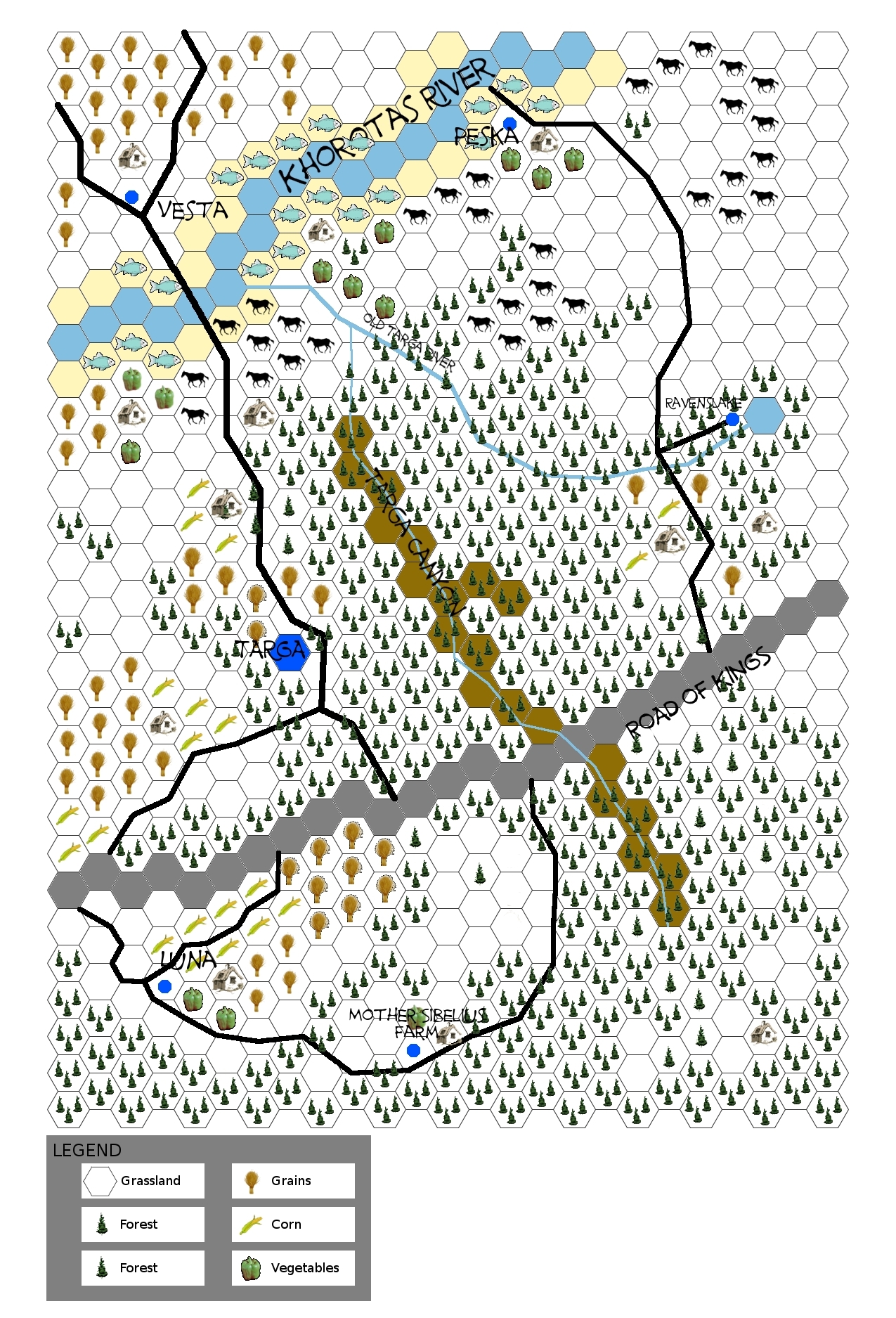
| 01:47, 28 May 2013 | Targa Area Resources.jpg (file) |  |
1.31 MB | Cal | Hex map representation of major resources and geography of Targa area. | 1 |
| 22:59, 15 August 2010 | File.jpeg (file) |  |
1.49 MB | Cheathj | 1 | |
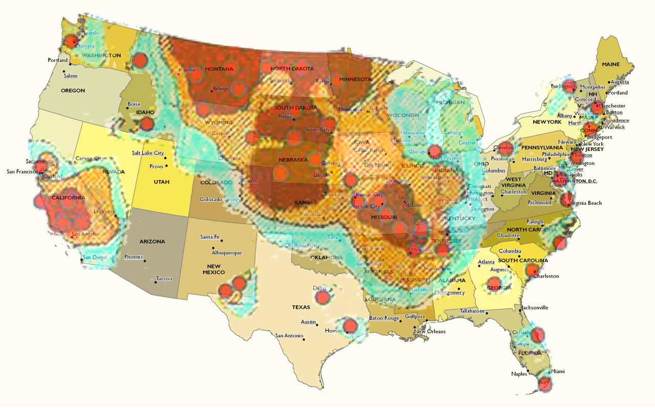
| 21:14, 23 January 2016 | Map of the United States 1877.jpg (file) |  |
1.77 MB | Cal | 1 | |
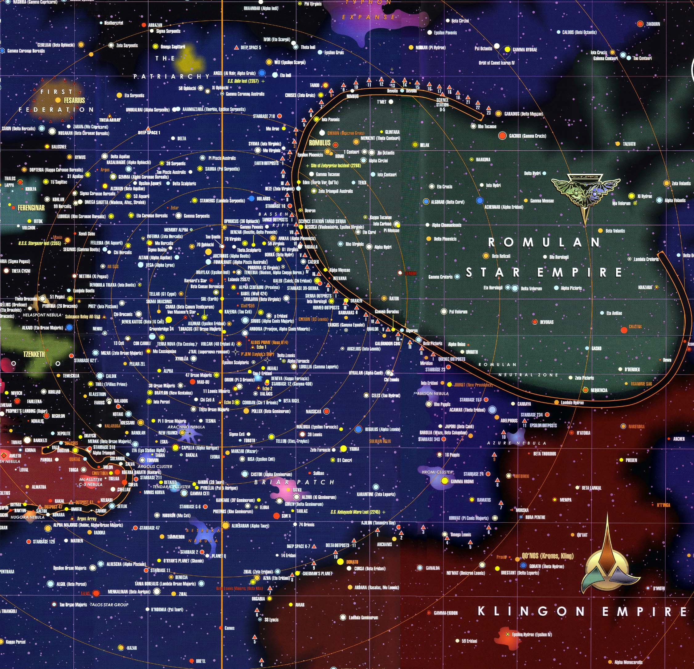
| 08:10, 27 August 2012 | Federation Space.jpg (file) |  |
2 MB | Cal | 1 | |
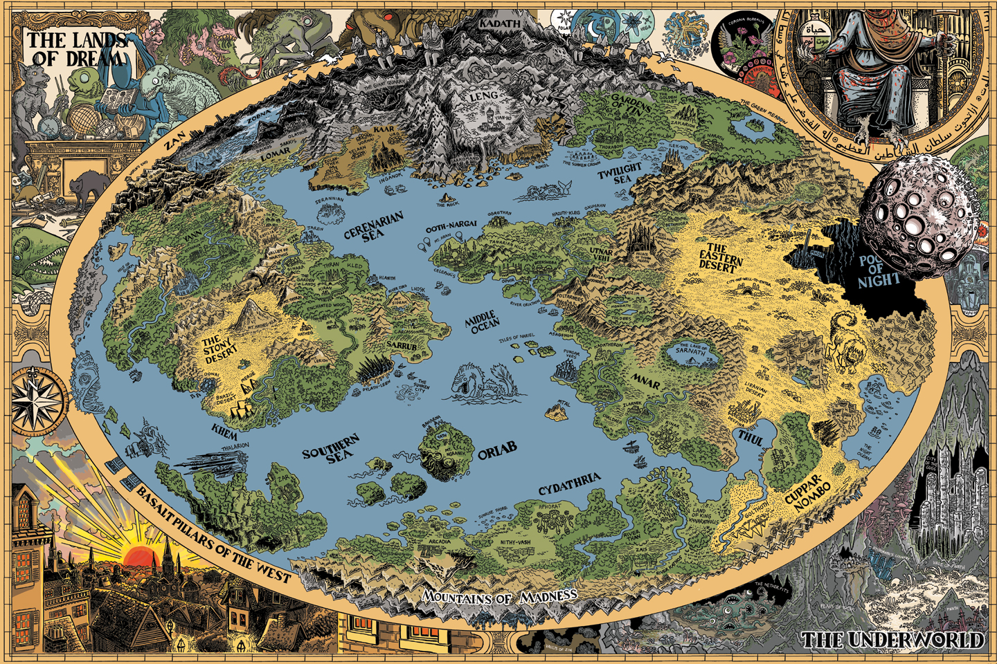
| 02:19, 1 September 2016 | Dreamlands01.jpg (file) |  |
2.02 MB | Cal | 1 | |
| 19:31, 13 August 2016 | Phoenix Domain Expansion Plans (med).jpg (file) | .jpg) |
3.35 MB | Cal | 1 | |
| 02:10, 7 May 2015 | Avondale Trade Guild Map.jpg (file) |  |
3.51 MB | Cal | Avondale Trade Guild Map, 3085 | 1 |
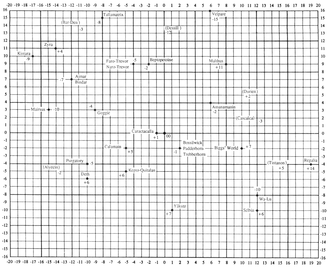
| 21:16, 22 July 2016 | GALAXY HEX MAP.jpg (file) |  |
3.62 MB | Cal | 1 | |
| 17:06, 22 April 2011 | Wycklow.jpg (file) | Error creating thumbnail: File with dimensions greater than 12.5 MP |
5.36 MB | Cal | Version 2.0. Improved map features colors and cleaner lines, as well as more labeled locations. Future versions of the map will be similarly updated. | 2 |
| 07:08, 19 March 2013 | Large Map Of Hyboria.jpg (file) | Error creating thumbnail: File with dimensions greater than 12.5 MP |
5.65 MB | Cal | Very large (6 Mb) and detailed map of Hyboria in JPEG format. Designed by a fan whose identity is unknown to this editor. | 1 |
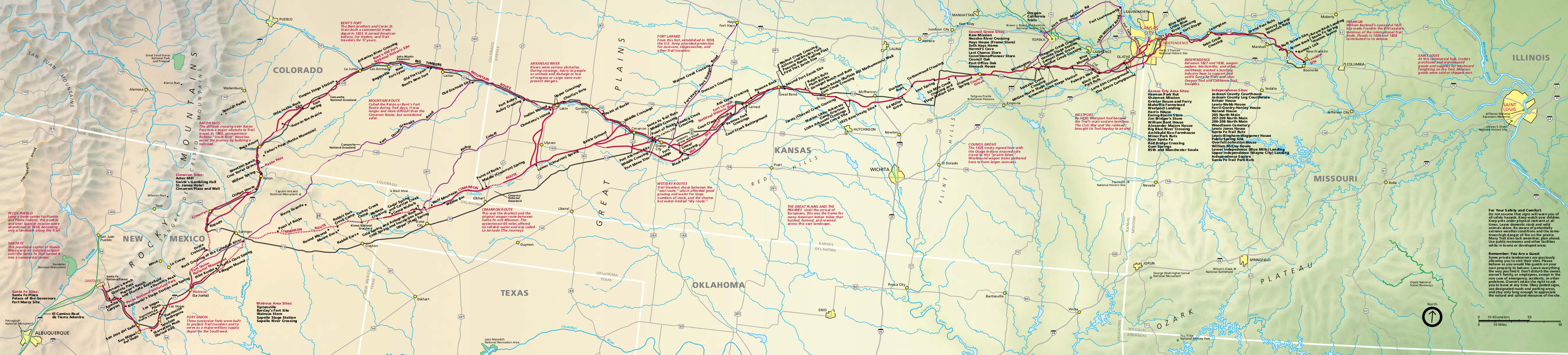
| 22:05, 6 November 2014 | Santa Fe Trail NPS map.png (file) | 6.48 MB | Cal | Detailed map of Santa Fe Trail from US National Park Service | 1 |